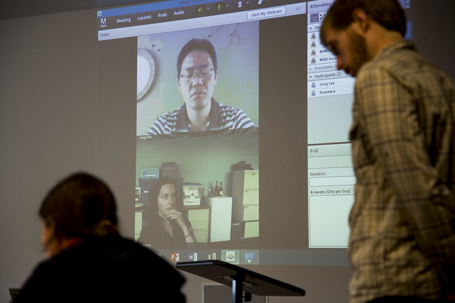
Chapel Hill, NC- Serious brain muscles were flexed at the software developers’ version of the Olympics—a “hackathon,” held at RENCI Europa Center, to work towards a collaborative goal of improving water modeling software important for future water scientists and researchers.
In-person and remote participants from several disciplines joined the hackathon team from July 22-24. The three days were spent working to improve the functionality of the Regional Hydro-Ecological Simulation System (RHESSys), a hydroecological modeling framework designed to simulate the combination of water, carbon, and nutrient cycling among the soils and vegetation of a watershed. This was the second hackathon in three months held by collaborators in the Water Science Software Institute (WSSI), an NSF-funded project to create a national center to advance water science by improving the software used to model hydrologic phenomena.
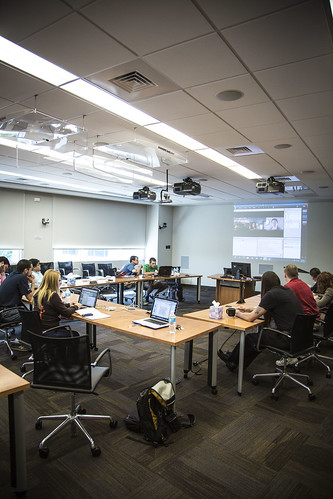
Participants in the hackathon included researchers from RENCI, the Institute for the Environment at UNC Chapel Hill and WSSI collaborators from the National Socio-Environmental Synthesis Center (SESYNC) at the University of Maryland and the National Center for Supercomputing Applications (NCSA) at the University of Illinois at Urbana-Champaign. The event was structured to encourage collaboration: each day started with a meeting to discuss goals and ended with another to relay progress and provide feedback. The participants spent the rest their time in small groups mapping out plans on white boards, coding, and coordinating their efforts to ensure they were working towards the same goal.
“The hackathon idea is simple: What happens if you bring together software engineers, scientists and the students and researchers who often do the brunt of the labor involved in research software development?” said RENCI Director and one of the WSSI Principle Investigators (PIs) Stan Ahalt, PhD. “If you put these people in a room, get them collectively focusing on the problems and brainstorming on solutions, you are likely to make substantial progress in improving the software and accelerating the science.”
The July event was intended to build on the accomplishments of the previous hackathon, held over five days in April, when the developers first began “hacking” at RHESSys. The software, which has previously been used to model the effects of land management on ecosystem productivity and water availability in mountainous watersheds, is now increasingly being used to understand how green infrastructure projects such as rain gardens can reduce stormwater pollution in urban ecosystems.

Attendees collaborate at the Hackathon event on the RENCI campus in Chapel Hill, NC.
The second hackathon continued developing the capabilities of RHESSys to simulate the performance of these green infrastructure plans (e.g. residential rooftop disconnections, rain gardens). Different teams worked on restructuring RHESSys and enhancing its ability to visualize green infrastructure design.
“The intensive three-day WSSI RHESSys Hackathon allowed us to make rapid progress on three fronts: improving simulation of green infrastructure, making RHESSys easier to use, and engineering more sustainable software,” said Brian Miles, M.S., a graduate student working under another of the WSSI PIs, Larry Band, PhD, of the UNC Chapel Hill Institute of the Environment. Miles led the team at RENCI while Band communicated remotely from Annapolis, Maryland.
Over the long term, the WSSI plans to develop more accessible software that can be used by a larger community. Currently RHESSys is difficult for non-experts to implement, making it inaccessible for ecologists and landscape architects to understand the impacts of green infrastructure. By integrating a web-based GIS interface into the software, the hackathon participants hope to expand the ability of scientists and nonscientists to assess the efficacy of green infrastructure. For example, an improved RHESSys will make it easier for homeowners, gardeners, urban planners and others to visualize soil moisture levels over time and at different locations in rain gardens compared to standard lawns.
“Our end goal is to transform RHESSys into a software tool that can easily be used by people who are not software experts,” Ahalt said. “For example, we envision urban planners using RHESSys to model water runoff for everything from large developments to single parcels of land. It could be a valuable decision support tool for green development projects that seek to maximize the use of water runoff for gardens and irrigation while still preventing flooding.”
Media Contact:
Karen Green, RENCI
919.445.9648 (office)
919-619-8213 (mobile)
kgreen@renci.org
@renci


